 Nye County, Nevada

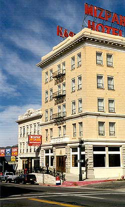
From 1907, this national historic
landmark has been beacon to Route 6 travelers approaching
Tonapah. Clean, cheap rooms and a small casino in the lobby
was a formula that could not be beat. Alas, the Mizpah was closed in 2001.
Until the Hotel Nevada in Ely was built in 1928, the Mizpah was the
tallest building in the state of Nevada.
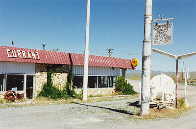
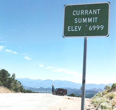
At one time, perhaps ending soon
after Interstate highway routes became popular for crossing Nevada, some
crossroads in the middle of Nevada were home to roadside services for
travelers. Current Station, pictured above in July
1998, included a gas station, motel, cafe, and bar.
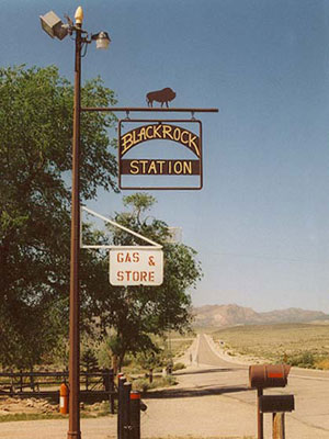
As of May 2003, the only services on
this 167-mile stretch between Tonopah and Ely are at Black Rock Station,
96 miles east of Tonopah. (right)
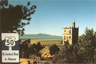
Move over Route 50, Route 6 is the
loneliest. Route 50 across Nevada claims to be "the loneliest road" in
America. Not so. The stretch of Route 6 from Tonopah to Ely is
lonelier. (above: July 1998 photo) The postcard on the left
shows Stokes Castle, on Route 50 near Austin
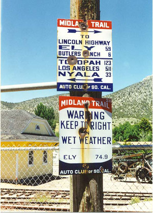
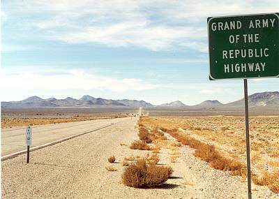
The predecessor to Route 6 in this
region was the Midland trail, connecting Los Angeles to the Lincoln
Highway through Ely. Originally located southwest of Ely, these signs are
now posted at the Historical Museum in Ely. (July1998 photo)