 Rhode Island - Massachusetts Border

Rhode
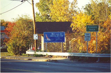
Island-Massachusetts border. (October 2000 photo)
|
Rhode Island - Massachusetts Border
|
|
Rhode
Island-Massachusetts border. (October 2000 photo) |
|
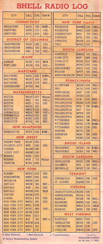 |
Why was this radio station list included with a 1938 Shell road map of Massachusetts, Connecticut, and Rhode Island? By that year a new phenomenon, and a new form of entertainment, had burst onto the scene for highway travellers--the car radio. Before the Great Depression millions of automobiles and millions of radios had been produced in the United States. But before 1932, no cars had radios. After being developed in the early 1930s, the number of car radios in use surged as the United States drew slowly out of the Depression. According to the World Almanac (1949), their numbers increased to over one million in 34 and to six million in 1938. After World War II, radios became a common feature in cars; over 38 million were in use by 1957. Exploring the AM radio dial to find interesting stations, locally and more distant, became a common sport for highway travellers during the two-lane highway era (and still is for some of us). Local stations provide travellers with an audio place experience, to complement their visual experience as they drive through. Tuning in to more powerful regional stations updates the traveller on happenings in larger cities. Among the more powerful stations--then as well as today--serving daytime listeners along Route 6 in the east are: WWVA Wheeling, KDKA Pittsburgh, WABC New York, WTIC Hartford, and WBZ Boston. Of course, the car-listening adventure increases dramatically at night, when these and other major stations bounce their signals off the ionosphere to distances of hundreds of miles. So, Route 6 travellers east of the Mississippi have drawn on the audio offernings of such AM giants as WSB Atlanta, WLW Cincinnati, WWL New Orleans, WCCO St. Paul/Minneapolis, and KMOX St. Louis. Who could forget the experinence of listening, hundreds of miles away, to the Grand Ole Opry on WSM in Nashville, or the super-powerful Mexican border radio stations such as XERF? |