 Illinois - Indiana Border

Through its entire history Illinois Route
6 cut a straight path across southern Cook County on 159th
Street. And for most of its history it cut a gracefully curving
path on Ridge Roade in northwestern Indiana. Over the years
it has crossed into Indiana in different locations, including
159th Street extended into the Hoosier state. For several decades it turned south in
Illinois on Torrance Avenue (as it does today) in
Illinois, then turned east into Indiana.
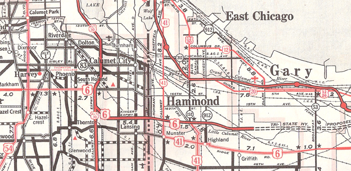
This 1959
Official Illinois State Road map shows Route 6 crossing the border on the
new Kingery Expressway, todays I-80 and I-94. In Indiana Route
6 joined an incredible bundle of east-west transportaion routes incluiding
U. S. highways 12, 20, and 30 (just off the map to the south) and several
railroads, including the New York Central, the Pennsylvania, the Baltimore
& Ohio, the Wabash, the Erie, the Nickle Plate,
and the Grand Trunk, in addition to some local and beltway lines.
At the
Illinois-Indiana border Route 6 currently is duplexed with two very busy
Interstates, 80 and 94. Frankly, among all thirteen Route
6 state border crossings, this one ranks near the bottom in
asthetic/scenic appeal.