Mesa County, Colorado


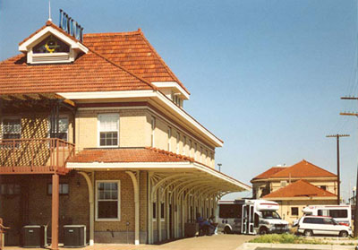
Alongside old Route 6 at the southwest corner of downtown Grand Junction are two magnificent railroad Depots. On the left is the Denver and Rio Grand Western crew station, and on the right is the passenger station that over the years has hosted famous trains including the California Zephyr. Route 6 follows the D&RGW route in western Colorado and eastern Utah. (May 2003 photo)
Three generations of Route 6 east of Grand Junction are shown in this July 1998 photo.  In the foreground is the old-old highway; to the far right is the current highway and to its left is an older version that serves as a frontage road.
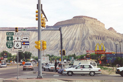
A busy day on Route 6 just east of Grand Junction. From here eastward, all the way to Walcott in central Colorado, the highway follows the Colorado River along with the D&RGW and I-70. Two famous visual icons along the route are juxtaposed in this May 2001 photo: Little Book Cliffs in the background and McDonald's arches in the foreground.

Just east of Grand Junction, Palasade is a wine and fruit paradise.  This 1950s postcard, looking west, shows Route 6 in the foreground and Mount Garfield in the backgound.


In 1931, just upstream from Palisade, the Colorado River Highway was squeezed into the valley alongside the Denver Rio Grande & Western Railroad. The monument on the left, which celebrates this road, is on the south side of I-70 at exit 49. Along with Route 6 becoming transcontinental came many other road improvements, including bridges like this 1937 bridge over the Colorado River just east of Palisade. (July 1998 photos)

Back to Colorado Counties Map